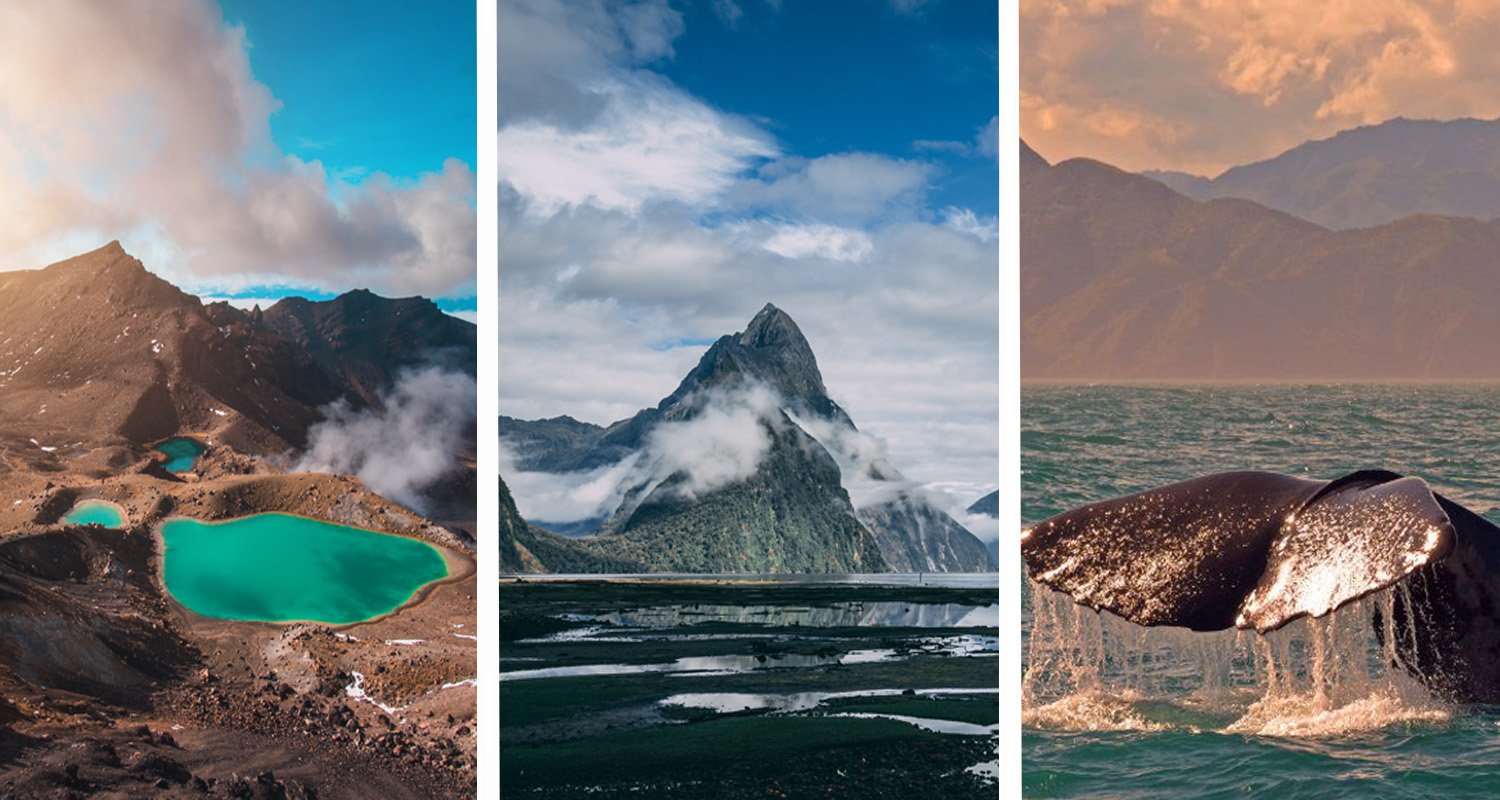

If you are new to New Zealand, one of the first things to understand is that the country is made up of two main islands: the North Island and the South Island, along with many smaller offshore islands.
The two main islands are separated by Cook Strait, and although they look relatively close on a map, they offer noticeably different landscapes and travel experiences. The North Island is generally associated with major cities, volcanic and geothermal landscapes, beaches and strong Māori cultural connections. The South Island is known for its larger mountain ranges, alpine scenery, glacial landscapes and dramatic wilderness.
This New Zealand North Island and South Island explained for beginners guide covers the geography, major regions, important cities, differences in landscape and the practical basics of travelling between the islands.
New Zealand North Island and South Island: the basics
The easiest way to picture New Zealand is as a long, narrow island country in the southwestern Pacific Ocean.
Its two largest islands are:
| Feature | North Island | South Island |
|---|---|---|
| Common Māori name | Te Ika-a-Māui | Te Waipounamu is commonly associated with the South Island |
| Position | Northern of the two main islands | Southern of the two main islands |
| Major city | Auckland | Christchurch |
| Capital city | Wellington | — |
| Landscape | Volcanic, geothermal, coastal and rolling | Alpine, mountainous, glacial and rugged |
| Well-known destinations | Auckland, Rotorua, Taupō, Wellington, Bay of Islands | Christchurch, Queenstown, Wānaka, Aoraki/Mount Cook, Fiordland |
| Particularly known for | Cities, culture, geothermal areas and beaches | Mountains, lakes, fiords and outdoor adventure |
New Zealand is actually an archipelago, meaning a country made up of a group of islands. Te Ara notes that New Zealand has more than 700 offshore islands, although most are small and lie relatively close to the two main islands.
So when travellers talk about “the North Island” and “the South Island”, they are referring to the country’s two principal islands rather than every island that forms part of New Zealand.
→ Source: New Zealand is an archipelago made up of two main islands and many smaller offshore islands, as explained by Te Ara — Encyclopedia of New Zealand.
Where are the North Island and South Island?
The North Island sits above the South Island. They are separated by Cook Strait, the stretch of water between Wellington on the North Island and the Marlborough region around Picton on the South Island.
At its narrowest, Cook Strait is roughly 20 kilometres wide
This geography is important when planning a holiday because you cannot simply drive from one island to the other. You need to either:
- Take a ferry across Cook Strait, with or without a vehicle.
- Fly between airports on the two islands.
The ferry route connects Wellington and Picton. Interislander advises allowing about three and a half hours for the sailing, although schedules and conditions can vary.
For travellers short on time, flying is another practical option. Domestic flights connect major centres including Auckland, Wellington and Christchurch.
What is the North Island like?
The North Island has a particularly varied mix of urban areas, farmland, coastline, volcanic landscapes and geothermal features.
It is the island many first-time visitors encounter through Auckland, New Zealand’s largest city and an important international gateway.
Further south, the landscape changes considerably. Central areas around Rotorua, Taupō and Tongariro contain some of the country’s best-known volcanic and geothermal environments.
Tourism New Zealand describes the North Island as a combination of lively cities, island sanctuaries, culture, history and diverse coastal landscapes.
→ Source: For a broader overview of destinations and landscapes, see the official North Island guide from 100% Pure New Zealand.
Major North Island areas to know
You do not need to memorise every region before visiting. For a beginner, these are the most useful names to recognise.
Auckland
Auckland is in the upper North Island and is one of the main entry points for international visitors.
The city sits around a large natural harbour and has easy access to beaches, islands and regional parks. It can therefore feel quite different from a typical large city despite being New Zealand’s biggest urban centre.
Northland and the Bay of Islands
Northland occupies the northernmost part of the North Island.
The region is associated with beaches, coastal scenery, maritime activities and important New Zealand history. If you look at a map, the long peninsula extending north from Auckland is Northland.
Rotorua
Rotorua is in the central North Island and is particularly famous for geothermal activity.
Visitors can encounter geysers, boiling mud, hot pools and other evidence of volcanic activity. Rotorua is also an important destination for Māori cultural experiences.
Taupō
Lake Taupō is a major geographical feature in the centre of the North Island.
The lake occupies the caldera of a large volcanic system and forms part of a wider volcanic landscape. Taupō is also a useful base for exploring central North Island attractions.
Tongariro
Tongariro National Park lies in the central North Island and is dominated by volcanic mountains.
The region is a good example of why New Zealand’s geography cannot be separated completely from its cultural history. The mountains have deep cultural and spiritual significance for Māori, particularly Ngāti Tūwharetoa.
Wellington
Wellington is the capital of New Zealand and sits at the southern end of the North Island.
This is useful to remember when planning a map-based itinerary: Wellington is still on the North Island. The South Island begins after crossing Cook Strait to Picton.
Wellington is therefore a natural transition point for travellers travelling overland from the North Island to the South Island.
What is the South Island like?
The South Island has a more mountainous character overall.
The Southern Alps form a major geographical backbone through much of the island, creating a dramatic landscape of mountains, valleys, lakes and alpine environments.
Tourism New Zealand describes the Southern Alps as stretching for roughly 500 kilometres and identifies Aoraki/Mount Cook as New Zealand’s highest mountain at 3,724 metres.
The South Island is also home to extensive wilderness areas, including Fiordland in the southwest.
→ Source: For more information about alpine landscapes, regions and major destinations, explore the official South Island guide from 100% Pure New Zealand.
Major South Island areas to know
Picton and Marlborough
Picton is one of the first South Island locations many ferry passengers encounter.
It sits at the head of Queen Charlotte Sound in the Marlborough region and is an important transport connection between the North and South Islands.
Marlborough is also well known for vineyards and wine tourism.
Nelson and Tasman
The northern part of the South Island includes Nelson and the Tasman region.
This area combines coastline, forests, mountains and access to Abel Tasman National Park.
Christchurch and Canterbury
Christchurch is the largest major urban centre on the South Island.
The wider Canterbury region stretches from the Pacific coast towards the Southern Alps and includes extensive plains as well as high mountain landscapes.
Christchurch is also a major transport hub for South Island road trips.
Aoraki/Mount Cook
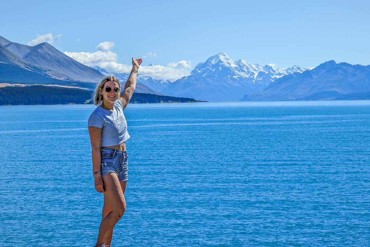
Aoraki/Mount Cook is New Zealand’s highest mountain.
The surrounding national park provides access to some of the country’s most recognisable alpine landscapes, including mountains, glaciers and valleys.
For a beginner looking at a New Zealand map, this is one of the easiest places to associate with the South Island: Aoraki/Mount Cook = central South Island alpine scenery.
Wānaka and Queenstown
Wānaka and Queenstown are in the mountainous southern part of the South Island.
They are surrounded by lakes and alpine landscapes and are popular bases for hiking, skiing and other outdoor activities.
Queenstown is also an important tourism and adventure hub.
Fiordland
Fiordland occupies a large area in the southwest of the South Island.
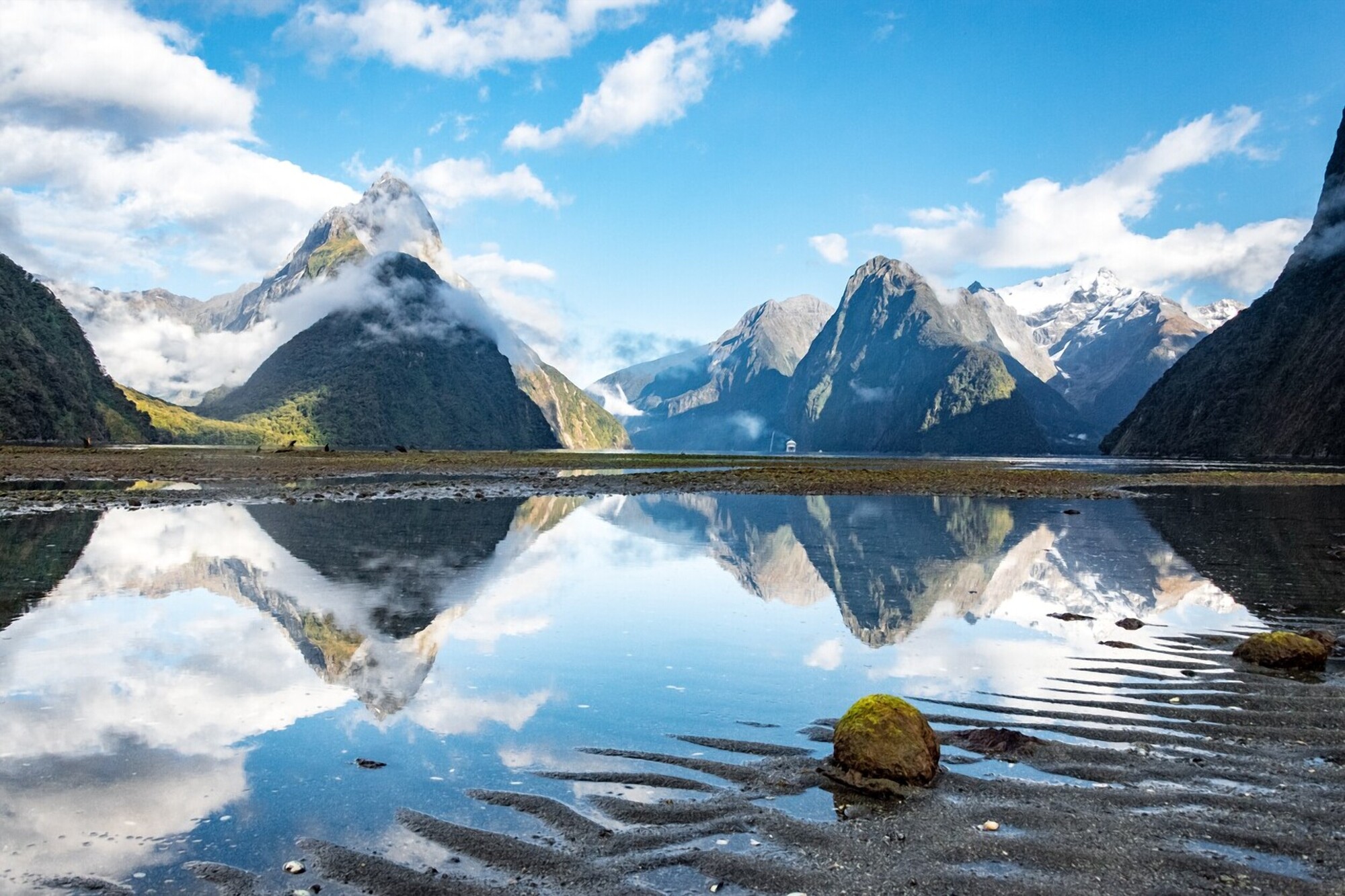
Its landscape was heavily shaped by glaciers, creating deep fiords, steep mountains, lakes and valleys. The region includes Milford Sound/Piopiotahi and Fiordland National Park.
The wider Te Wāhipounamu World Heritage Area includes Fiordland, Aoraki/Mount Cook, Mount Aspiring and Westland Tai Poutini national parks.
North Island vs South Island geography
The biggest geographical difference is the type of landscape you are likely to encounter.
The North Island has a strong volcanic and geothermal identity, particularly around the central plateau. It also has extensive coastlines, rolling countryside and major urban centres.
The South Island is dominated more strongly by mountains and alpine landscapes, particularly through the Southern Alps.
That does not mean the North Island has no mountains or that the South Island has no beaches. Both islands contain an enormous variety of environments.
A better way to remember the distinction is:
- North Island: volcanic landscapes, geothermal areas, beaches, rolling countryside and major cities.
- South Island: Southern Alps, glacial landscapes, lakes, fiords and extensive wilderness.
- Both: beaches, forests, hiking, wildlife, farmland, lakes and opportunities for outdoor activities.
The contrast is partly explained by the islands’ geology. Te Ara describes the North Island as having extensive rolling hill country alongside volcanic areas, while the Southern Alps form the major mountain system of the South Island.
Is the South Island bigger than the North Island?
Yes. The South Island has more land area than the North Island, despite the North Island generally being the more densely populated of the two.
Historical official New Zealand geographic data lists approximately 150,437 square kilometres for the South Island compared with 113,729 square kilometres for the North Island.
This is useful for travellers because the South Island can look deceptively manageable on a map.
A road journey that appears short visually can take considerably longer because of winding roads, mountain passes, weather conditions and the need to stop and enjoy the scenery.
In other words, map distance is not the same as travel time.
→ Source: The Stats NZ New Zealand Official Yearbook provides useful geographic data on the relative size of New Zealand’s two main islands and Cook Strait.
Which island has New Zealand’s major cities?
The easiest city map for beginners is:
North Island
- Auckland — largest city and major international gateway
- Hamilton — inland city in the Waikato
- Tauranga — major Bay of Plenty city
- Wellington — capital city at the southern end of the island
South Island
- Christchurch — largest major urban centre on the island
- Dunedin — major southern city
- Queenstown — important tourism and adventure centre
- Nelson — major centre in the northern South Island
The important point is that New Zealand’s urban geography is spread across both islands.
If you fly into Auckland and later want to visit Queenstown, for example, you are travelling from the North Island to the South Island rather than simply moving between two cities on the same landmass.
How do you travel between the North Island and South Island?
There are two main choices: ferry or plane.
Option 1: Ferry
The most recognisable inter-island route is:
Wellington → Cook Strait → Picton
The ferry is particularly useful if you have a rental car and want to continue a road trip on the other island.
The crossing itself can also be part of the travel experience because you pass through Cook Strait and the Marlborough Sounds.
Allow extra time around the sailing rather than treating the crossing as an exact point-to-point journey. Interislander recommends arriving well before departure and notes that weather can affect services.
Option 2: Domestic flight
Flying is generally the simpler option when saving travel time is more important than experiencing the ferry journey.
For example, travellers can fly between Wellington and Christchurch, or connect through other major airports. Air New Zealand currently operates direct domestic services on several major North–South routes.
Which should a beginner choose?
Use this simple rule:
- Choose the ferry if you are road-tripping and want to take a vehicle between islands.
- Choose a flight if you are short on time or your itinerary does not require a vehicle crossing.
- Check schedules close to departure, particularly for ferry travel, because weather and operational conditions can affect services.
→ Source: If you are travelling between the islands by ferry, check the Interislander Cook Strait ferry timetable for current sailing information.
Do you need to visit both islands?
No.
One of the most important things for a first-time visitor to understand is that you do not need to see both islands on one trip.
 If you are still deciding which island suits your travel style, see our North Island vs South Island comparison for a closer look at the differences.
If you have only several days, choosing one island or even one region can produce a much more enjoyable holiday than trying to cover the entire country.
For example:
- A short North Island trip could focus on Auckland, Rotorua and Taupō.
- A short South Island trip could focus on Christchurch, Aoraki/Mount Cook and Queenstown.
- A longer trip can combine selected destinations from both islands.
The mistake is not choosing one island. The mistake is assuming you must see everything.
Once you understand the geography, the next step is to plan a trip to New Zealand around your available time, preferred destinations and travel style.
A simple map-based way to understand New Zealand
If you are looking at a map for the first time, remember this sequence:
Northland → Auckland → central North Island → Wellington → Cook Strait → Picton → Christchurch/Canterbury → Southern Alps → Queenstown/Fiordland
This is not a recommended itinerary. It is simply a useful mental picture.
The country runs generally from northeast to southwest, with the North Island above the South Island. The Southern Alps then create a prominent mountain spine through the South Island.
Once you understand this layout, many New Zealand travel articles become easier to follow.
For example:
- “Central North Island” usually means the volcanic interior around places such as Rotorua and Taupō.
- “Upper South Island” generally refers to areas around Nelson, Tasman and Marlborough.
- “West Coast” usually means the western side of the South Island.
- “Lower South Island” includes areas around Queenstown, Fiordland, Southland and Dunedin.
Common beginner mistakes about the two islands
Thinking Wellington is on the South Island
It is not. Wellington is at the southern end of the North Island.
Assuming the islands are connected by a bridge
They are not. Cook Strait separates them, so travellers use a ferry or aircraft.
Trying to drive across both islands in a few days
This can create an exhausting itinerary. Allow time for mountain roads, scenic stops and weather.
Assuming the South Island is simply “colder”
The climate varies considerably within each island. Mountains, altitude, latitude and exposure to prevailing weather systems all matter.
Treating New Zealand as one uniform destination
The two main islands have different geographical identities. Choosing destinations based on the type of landscape you want to experience is more useful than simply counting famous attractions.
A beginner’s checklist before choosing an island
→ Source: Depending on your passport and circumstances, you may need an NZeTA, so check the current requirements before travelling.
Before booking your accommodation or transport, ask yourself:
- How many days do I have?
- Do I want cities, culture and geothermal attractions?
- Are mountains and alpine landscapes my priority?
- Am I planning to drive?
- Do I want to take a vehicle on the inter-island journey?
- Would I rather spend more time in fewer places?
- Am I interested in hiking or other outdoor activities?
- Which airport makes the most sense for my international and domestic flights?
→ Source: Before travelling to New Zealand, check the latest Immigration New Zealand visitor visa information to confirm the entry requirements that apply to you.
If you are visiting from overseas, also check your current New Zealand entry requirements before booking. Visa and NZeTA requirements depend on factors including your passport and how you are travelling, so Immigration New Zealand should be treated as the authoritative source rather than a travel blog.
Frequently Asked Questions
Is New Zealand just two islands?
No. New Zealand has two main islands—the North Island and South Island—plus many smaller islands. New Zealand is an archipelago with more than 700 offshore islands .
Which island is Auckland on?
Auckland is on the North Island, in the upper part of the island.
Which island is Wellington on?
Wellington is on the North Island, at its southern end. The South Island begins across Cook Strait, with Picton being an important gateway on the South Island.
Which island is Christchurch on?
Christchurch is on the South Island, on the east coast in the Canterbury region.
Can you drive from the North Island to the South Island?
Yes, but not continuously by road. You can drive your vehicle onto a Cook Strait ferry between Wellington and Picton. Alternatively, you can fly and arrange another vehicle at your destination.
Which island should I visit first?
That depends on what you want to see. The North Island is a natural starting point for travellers interested in Auckland, Māori culture, geothermal areas, beaches and volcanic landscapes. The South Island is particularly suited to travellers whose priority is mountains, alpine scenery, lakes, fiords and wilderness.
Final Takeaway
Understanding the New Zealand North Island and South Island is much easier once you stop thinking of them as two versions of the same destination.
The North Island is the northern half of the country, with Auckland, Wellington, volcanic landscapes, geothermal areas, beaches and many important Māori cultural experiences.
The South Island is larger geographically and has the Southern Alps, Aoraki/Mount Cook, Queenstown, Wānaka and Fiordland among its major geographical and tourism highlights.
Cook Strait separates the two, with ferries linking Wellington and Picton and domestic flights providing a faster alternative.
For a first visit, you do not have to choose both. Start with the island—or region—that best matches your interests, allow realistic travel time, and build your itinerary around experiences rather than trying to collect destinations from a map.